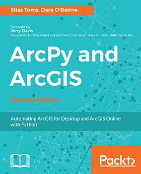
ArcPy and ArcGIS: Automating ArcGIS for Desktop and ArcGIS Online with Python, Edition 2
About this ebook
- - Perform GIS analysis faster by automating tasks.
- - Access the spatial data contained within shapefiles and geodatabases and transform between spatial reference systems.
- - Automate the mapping of geospatial analyses and production of map books.
- - Understand how to integrate Python into ArcGIS and make GIS analysis faster and easier.
- - Create Python script using ArcGIS ModelBuilder.
- - Learn to use ArcGIS online feature services and the basics of the ArcGIS REST API
- - Understand the unique Python environment that is new with ArcGIS Pro
- - Learn about the new ArcGIS Python API and how to use Anaconda and Jupyter with it
- - Learn to control ArcGIS Enterprise using ArcPy
If you are a GIS student or professional who needs an understanding of how to use ArcPy to reduce repetitive tasks and perform analysis faster, this book is for you. It is also a valuable book for Python programmers who want to understand how to automate geospatial analyses and implement ArcGIS Online data management.
Discover more
Ratings and reviews

- Flag inappropriate
- Show review history
About the author
Silas Toms is a certified GIS Professional and the author of the first edition of ArcPy and ArcGIS. President and founder of Loki Intelligent Corporation, a location information firm located in San Francisco, California, he is an expert in real-time geographic information systems and analysis automation. Along with Dara O'Beirne and Arini Geographics, he developed the real-time common operational picture used at Super Bowl 50 and all other events at Levi's Stadium in Santa Clara, California. This dynamic system was recognized by the White House and ESRI President, Jack Dangermond, as a unique and powerful application of GIS, allowing the federal, state, and local government to coordinate and communicate in real time, for the first time ever. As the President of Loki Intelligent, Silas is focused on unique applications of GIS that will power the future of location information. The sheer amount of data collected through sensors and mobile reporting demands automation and data processing improvements to turn the raw input into location intelligence. He believes that correct application of geospatial analysis, web mapping, and mobile data collection will improve the decision-making processes within the government and business. Loki is location information, and information is power.
Dara O'Beirne is a certified GIS Professional (GISP) with over 10 years of GIS and Python experience. He has earned both his bachelors and masters of art in geography from the San Francisco State University. He is currently a GIS analyst working at the City of Sacramento's Department of Utilities. Before joining the City of Sacramento, he was a GIS analyst for Arini Geographics at the City of Santa Clara in California. While in Santa Clara, he worked on converting the utility network AutoCAD data to ESRI's GIS Local Government Information Model. He was also an integral part of the GIS Team, which included Silas Toms, Cyrus Hiatt, Sherie Tan, and Gabriel Paun, that worked on developing a web mapping application used during each event at the new Levi's Stadium, including Super Bowl 50. Dara's professional experience also includes working with Towill Inc., a GIS and Land Surveying company in Northern California. At Towill, he played a central role in developing and implementing procedures related to the collection and analysis of LiDAR data for environmental and engineering applications. Prior to Towill, Mr. O'Beirne gained his professional GIS experience working for the Golden Gate National Recreation Area managed by the National Park Service, one of the largest urban park systems in the world, which includes national treasures such as Alcatraz, Muir Woods, and the Marin Headlands.